
Hydrodynamic and Morphodynamic Assessment for River Navigation Infrastructure
Numerical hydrodynamic and sediment transport modeling to assess the feasibility and impacts of navigation-related dredging works in the Paraguay River basin.
Overview
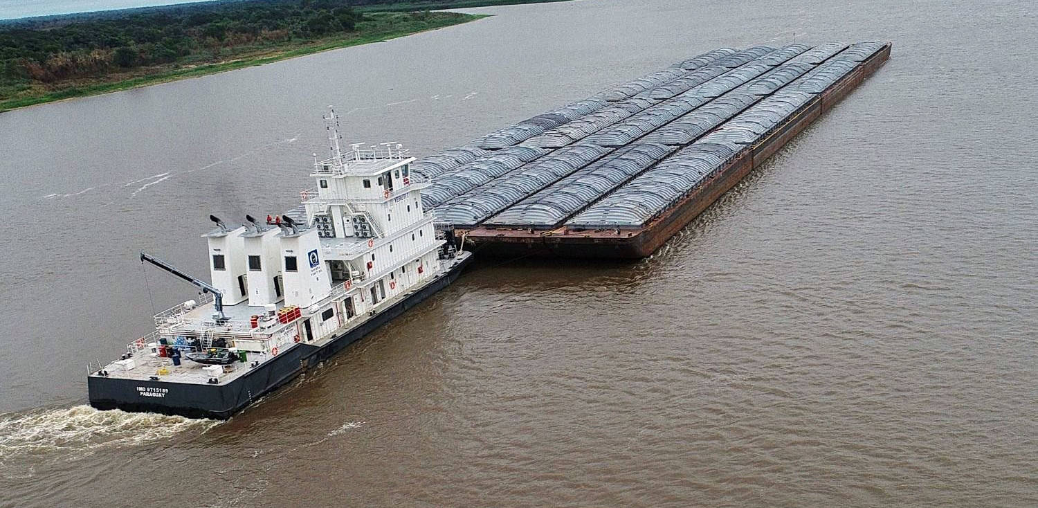
Navigation along large lowland rivers often requires localized interventions to ensure safe and reliable passage under variable hydrologic conditions. In the Paraguay River basin, the development of new river infrastructure associated with a logistics node motivated a technical evaluation of whether localized dredging and the construction of a sheltered maneuvering area could be carried out without adversely affecting river hydraulics, navigation safety, or sediment dynamics.
HCS performed an integrated hydrodynamic and morphodynamic modeling study to assess the feasibility of the proposed intervention and to characterize its hydraulic and sedimentary impacts across a range of representative river conditions.
The Challenge
The project involved a river reach characterized by:
- Strong curvature and asymmetric flow distribution
- Navigation traffic passing close to the intervention area
- Sediment transport dominated by both sandy bed material and fine suspended load
The key technical questions were:
- How the introduction of a sheltered maneuvering area would modify local flow patterns
- Whether the intervention could alter velocities or flow directions within the navigation channel
- If recirculation zones or stagnant areas would develop
- Whether the intervention would promote sedimentation requiring ongoing maintenance
- How sensitive the system response would be to different hydrologic conditions
Answering these questions required numerical tools capable of resolving both flow hydraulics and sediment transport processes at appropriate spatial scales.
Our Contribution
1. Two-Dimensional Hydrodynamic Modeling
HCS implemented a depth-integrated (2D) hydrodynamic model of the river reach using a finite-element framework suited to large rivers. The model domain extended well upstream and downstream of the intervention area to capture flow redistribution effects.
The model incorporated:
- High-resolution bathymetric data
- Detailed representation of the river banks and navigation channel
- Spatially variable hydraulic roughness
- Boundary conditions representing typical low, medium, and high river stages
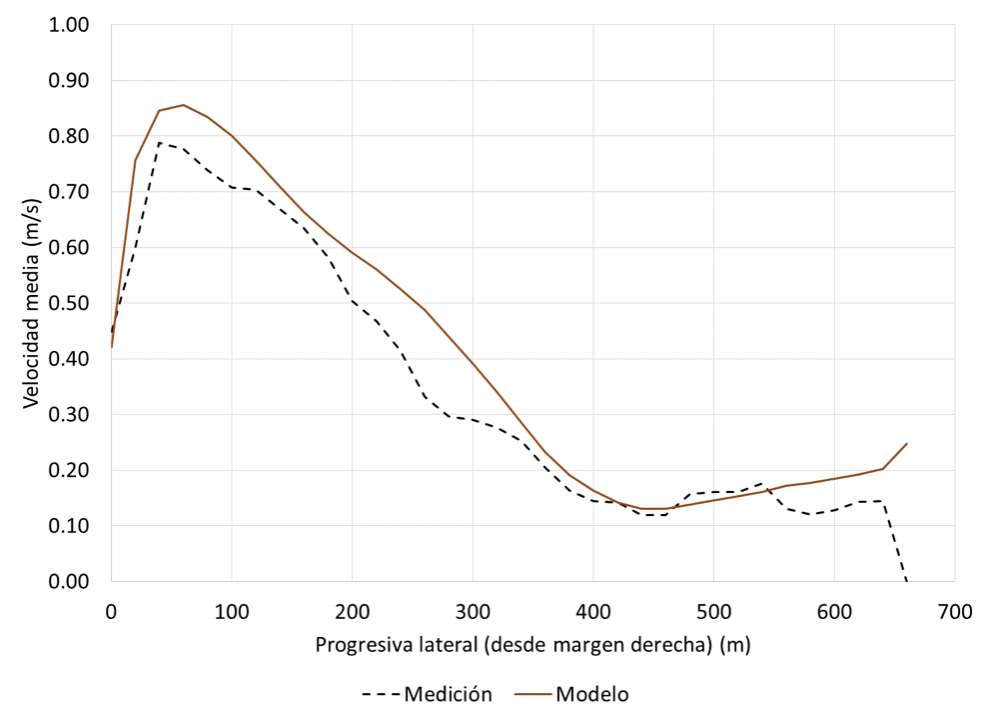
Model calibration was performed using available field measurements of water levels and current velocities, ensuring realistic reproduction of observed flow patterns.
2. Assessment of Hydraulic Impacts
The calibrated model was applied to evaluate the hydraulic effects of introducing the maneuvering area. The simulations showed that:
- Flow velocities in the main channel are only mildly affected near the intervention
- Depth variations remain localized and do not propagate along the reach
- Flow directions in the navigation channel remain essentially unchanged
- No persistent recirculation develops within the maneuvering area
This confirmed that the intervention does not compromise navigation conditions or river conveyance.
3. Sediment Transport and Morphodynamic Modeling
To complement the hydraulic analysis, HCS carried out sediment transport and morphodynamic simulations coupled to the hydrodynamic model. Two sediment fractions were represented:
- Bed material sands interacting with the riverbed
- Fine suspended sediments supplied from upstream
The modeling framework allowed the evaluation of both short-term deposition patterns and longer-term morphological tendencies by comparing scenarios with and without the intervention.
4. Evaluation of Sedimentation Risk
The morphodynamic results indicated that:
- The intervention causes only minor changes in sediment transport capacity
- Bed material adjustments are small and spatially limited
- Fine sediment deposition remains negligible under most conditions
- The absence of flow recirculation strongly limits the potential for sediment accumulation
Overall, the simulations showed that the maneuvering area is not prone to significant infilling and that its presence does not alter the natural morphological evolution of the river reach.
Key Findings
The integrated modeling demonstrated that:
- Two-dimensional numerical models are effective tools for evaluating navigation-related river interventions
- Localized dredging and sheltered areas can be designed without altering navigation channel hydraulics
- Sediment impacts remain limited when flow circulation patterns are preserved
- Combined hydrodynamic and sediment modeling provides a robust basis for feasibility assessment
These findings support the technical viability of the proposed intervention under a wide range of river conditions.
Outcomes and Client Value
Through this project, HCS delivered:
- A validated numerical framework for river intervention assessment
- Clear evidence of hydraulic compatibility with navigation requirements
- Quantitative evaluation of sedimentation and maintenance risk
- Technical support for decision-making at the feasibility stage
This case study highlights HCS’s expertise in large-river hydrodynamics, navigation infrastructure assessment, and sediment transport modeling in complex fluvial environments.
Contact
Request a consultation
Have a hydraulic challenge? Let's discuss how we can help.
Call Us
+54 2324 550433