
Hydrodynamic Study for Beach Stabilization in the Costanera Sur Ecological Reserve
Numerical wave modeling to support the conceptual design of coastal protection works in the Costanera Sur Ecological Reserve (Buenos Aires).
Overview
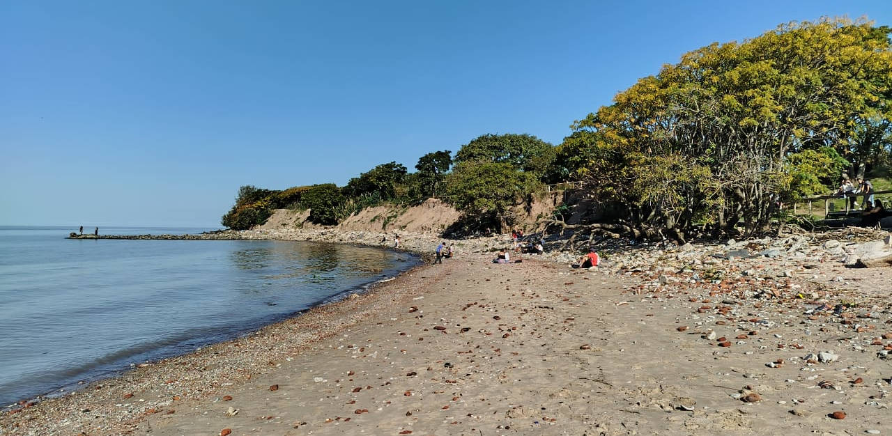
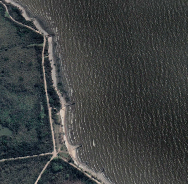
The Costanera Sur Ecological Reserve (RECS) includes a small natural beach along its central-eastern shoreline. Despite the presence of some local protection structures, this beach has been repeatedly impacted by erosion driven by wave action in the Río de la Plata. The Government of the City of Buenos Aires (GCABA) initiated a project to evaluate new, larger-scale coastal protection works capable of creating a more stable natural environment.
HCS contributed to this effort by developing a numerical modeling framework to characterize wave climate, assess erosive forces under frequent and extreme conditions, and support the conceptual design of coastal protection structures.
The Challenge
The RECS shoreline is exposed to:
- Direct wave action, including extreme storm waves (sudestadas)
- Elevated water levels accompanying storm events
- Sediment dynamics governed by current deceleration and fine-sediment deposition in sheltered zones
Beach stability in the area is primarily controlled by wave-induced bed shear stress, which increases significantly during strong easterly wind events.
GCABA required a defensible technical basis to determine:
- How waves and water levels contribute to erosion
- Differences in erosive exposure between the northern and southern sectors
- What types of coastal protection works could reduce erosive forces to manageable levels
- How to configure these works at a conceptual level
Our Contribution
HCS carried out a multi-stage numerical study combining wave generation and propagation modeling with local wave-action simulations at the RECS beach.
1. Wave Climate Characterization
Using a spectral wave model, we simulated wave conditions affecting the RECS shoreline. The analysis covered:
- Representative frequent wave scenarios
- Extreme storm scenarios
- Sensitivity to water levels typical of storm events
This provided a complete wave-climate context for the erosion analysis.
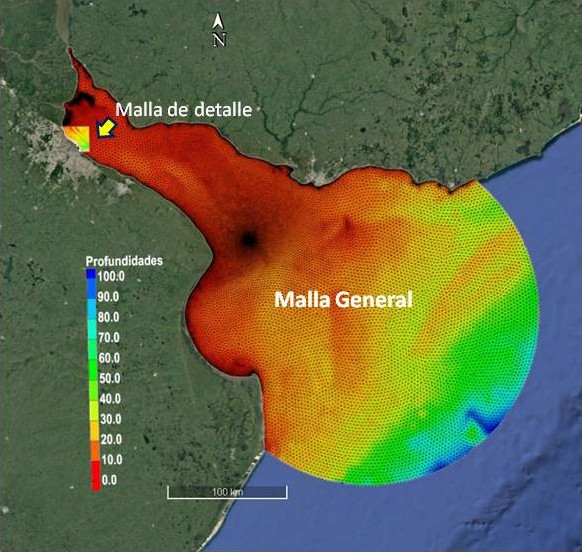
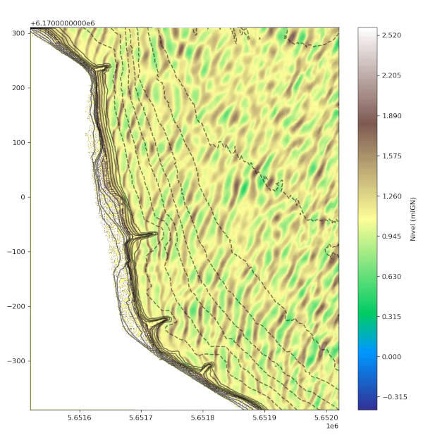
2. Nearshore Wave-Action Model
A detailed nearshore model was implemented to compute:
- Wave transformation over the local bathymetry
- Nearshore energy distribution
- Bed shear stress (via bottom shear velocity), used as an indicator of erosive potential
The preliminary simulations confirmed patterns consistent with field observations: higher shear stresses in the southern subzone, corresponding to stronger erosion there.
3. Stability Assessment of the Existing Beach
Additional analysis examined pre-intervention conditions and the response of the shoreline to various wave scenarios. This included:
- Evaluation of the current beach geometry
- Identification of the most vulnerable zones
- Definition of conditions under which erosion becomes critical
4. Conceptual Design of Protection Works
Based on the model results, several types of coastal protection structures were explored conceptually:
- Wave-blocking structures (e.g., breakwaters)
- Protective coverage works (e.g., revetments, rock armoring)
- Geoform-based configurations
- Complementary ecological measures, such as wetland construction
The effectiveness of proposed structures was evaluated by comparing modeled wave action for:
- Frequent wave scenarios
- Extreme storm conditions
This allowed identification of configurations that significantly reduce erosive forces at the beach.
Key Findings
Across the two project stages, the modeling provided:
- A quantitative description of wave forcing at the RECS shoreline under different hydrometeorological conditions
- Evidence that southern areas experience greater erosive stress, confirming field observations
- A clear framework for evaluating protection options based on their ability to reduce wave-induced shear
- Conceptual configurations of protection works capable of improving long-term beach stability
These results enabled GCABA to understand the physical drivers of erosion and identify feasible mitigation strategies.
Outcomes and Client Value
The numerical modeling system developed by HCS provided:
- A scientific basis for designing coastal protection in a sensitive natural reserve
- Scenario-based evaluation of erosive forces and structural performance
- A defensible methodology to support investment decisions at the pre-project stage
- Guidance for next design stages, including refinement and structural detailing
This project highlights HCS’s capability to combine hydrodynamic modeling, coastal process analysis, and conceptual engineering to support resilient and environmentally responsible urban shoreline projects.
Contact
Request a consultation
Have a hydraulic challenge? Let's discuss how we can help.
Call Us
+54 2324 550433